Reflections: Historical Data
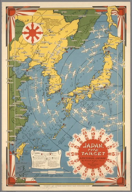
“Japan, the target : a pictorial Jap-map” By Ernest Dudley Chase of Winchester, Mass. Published and copyright, Ernest Dudley Chase, Winchester, Mass. Printed in U.S.A. 1942
The History faculty have been very frequent users of the spatial technology tools, including StoryMaps. In addition, my team has developed another type of project that requires less time for the students, but honestly, can have a significant impact.
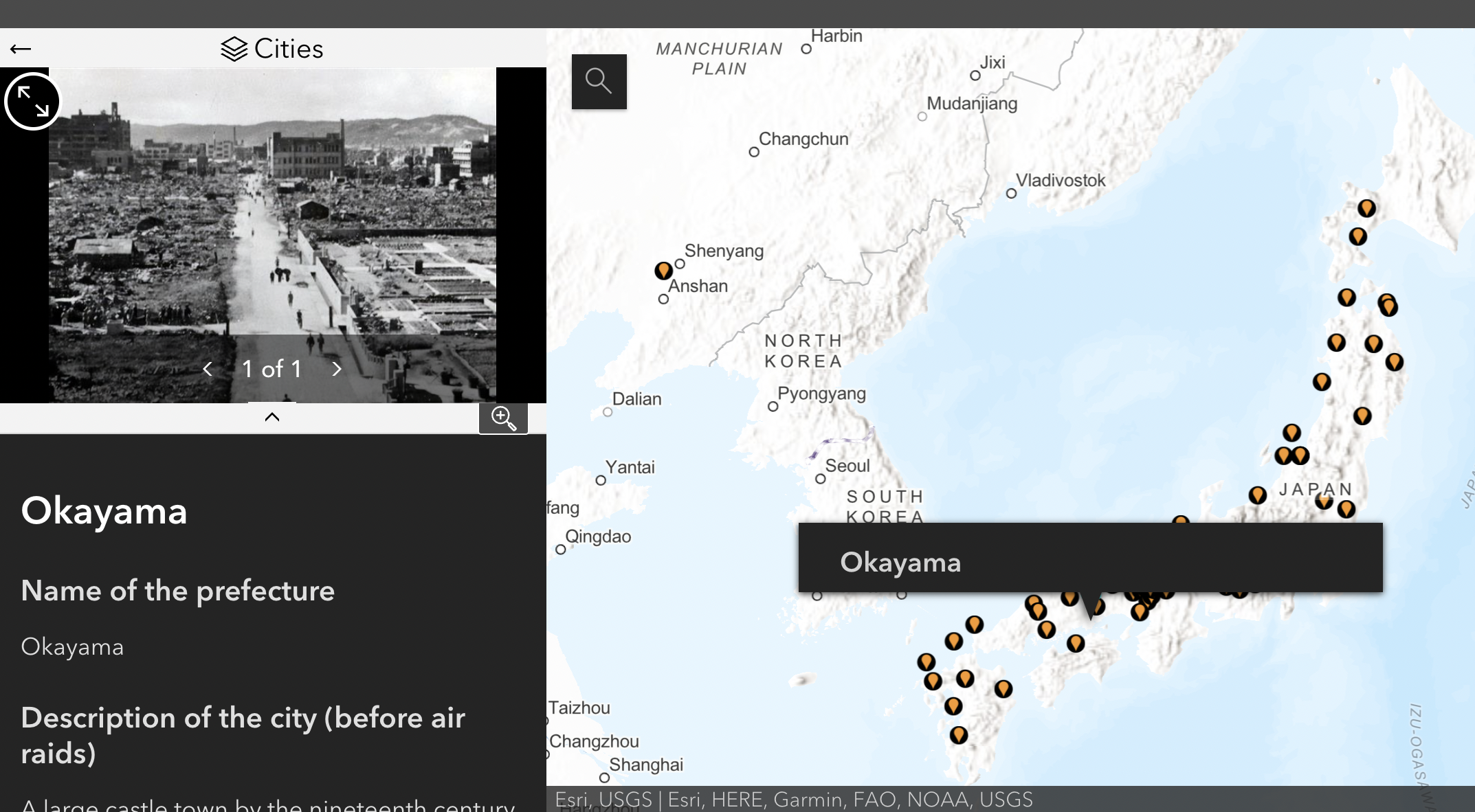
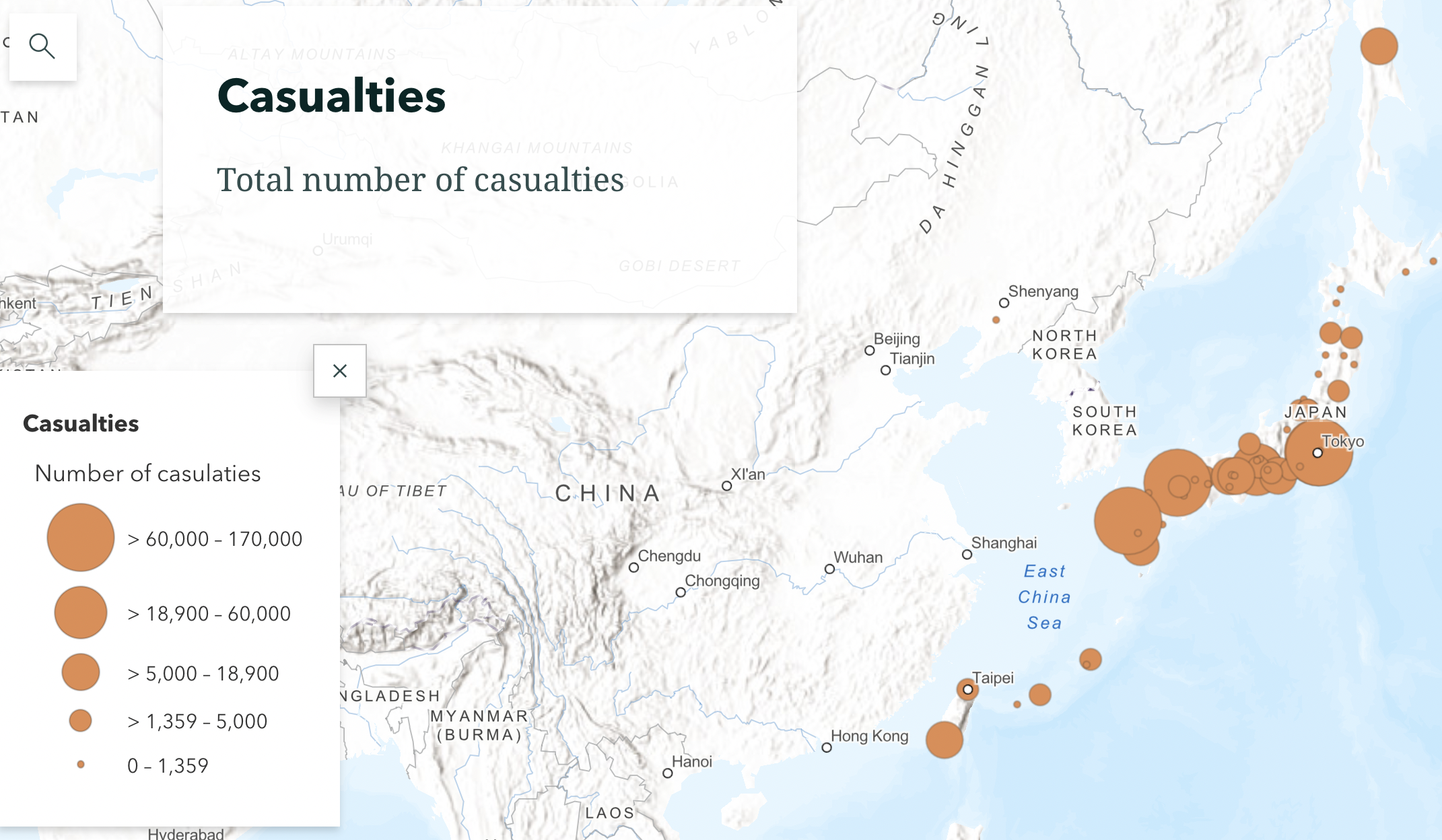
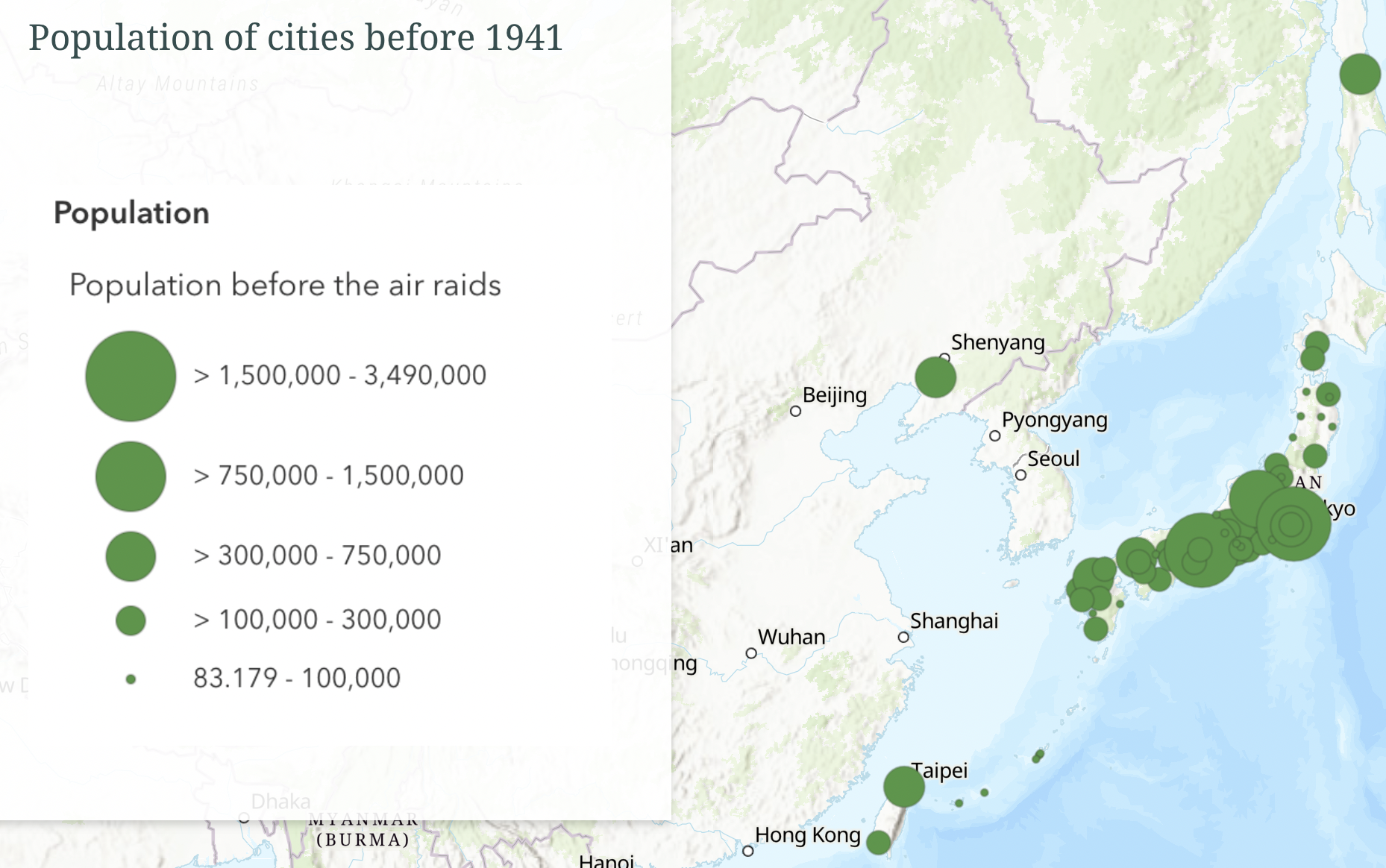
This particular activity, developed by Chris Saladin, has students analyzing primary source records from Japan about the impact of Allied air raids during WWII. Students are assigned one or more cities from the records, research the city and write a short description, find historical images and enter data about the population and casualities.
Objectives of the project include:
Students will understand the impact of WWII bombings on Japan across the country
Students will analyze the depth of impact on smaller towns
Students will understand that the war was more than Hiroshima and Nagasaki
Students will explore the geography of Japan
The story behind the primary source records is quite fascinating. These records were written in Japanese. The records were translated by a History PhD candidate and then made available for students to use.
Process
The StoryMaps team is involved in this project every year, as it uses some slightly more complex mapping that we expect the students to learn.
I create a survey in Esri’s Survey 123 software and share it with the instructor. We have now used the survey for several years, and refine it slightly as we learn what works best.
The students are assigned one or more cities to research, depending on the number of students in the course. Students are expected to do a couple of hours of research and writing. It is not a major project in the course in terms of amount of time spent.
Students enter the information into the survey. Questions include:
Name of city and prefecture
Location of the city on the map
Background about the city
At least one historical image
Description of the bombings on the city
Pre-war population
Post-war population
I take this data and create several maps and put them into a StoryMap.
The class explores the maps together.